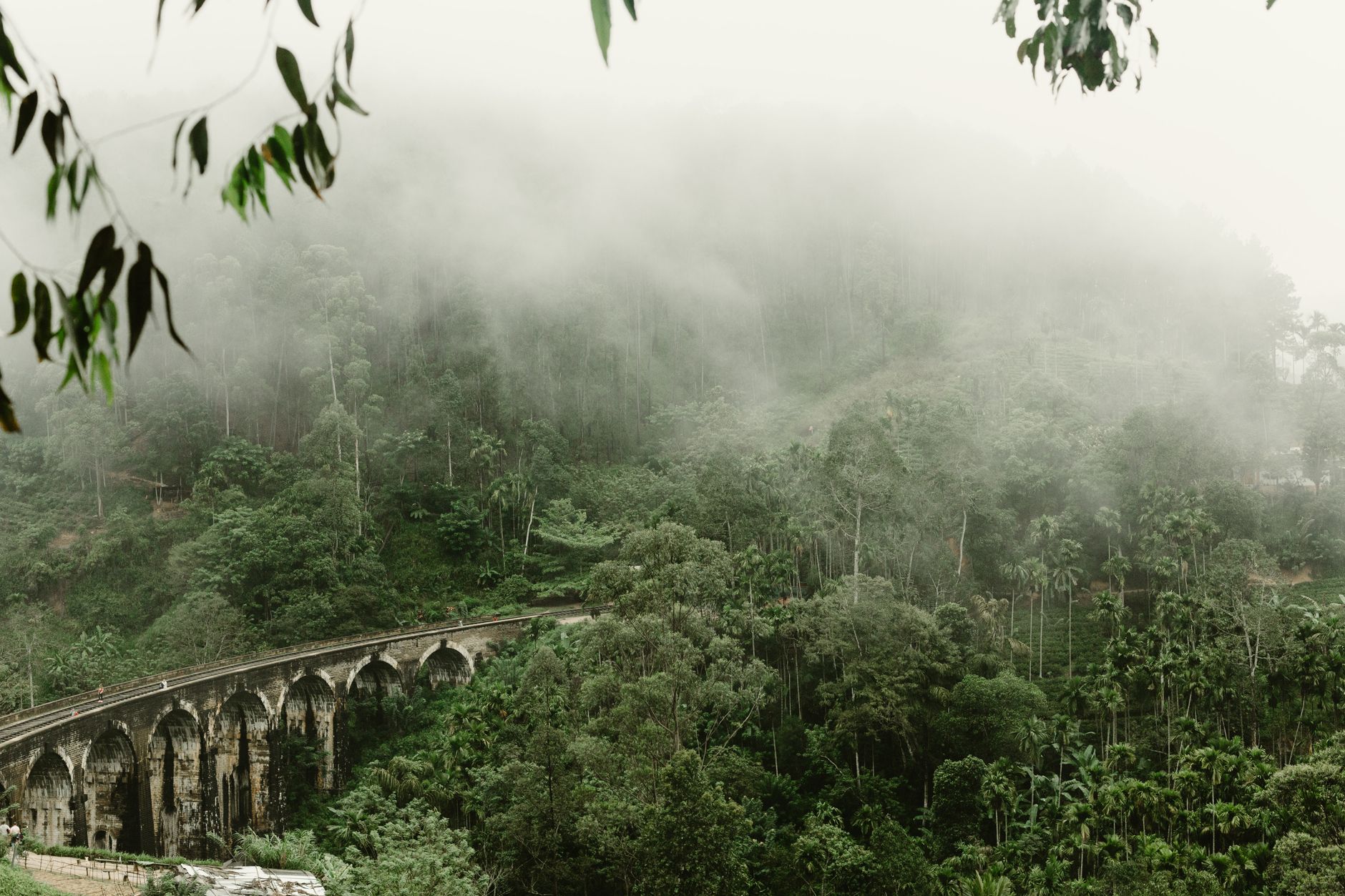
Nine Arch Bridge Viewpoint: A Practical Guide
The Nine Arch Bridge is a 1910s railway viaduct near Ella that's become Sri Lanka's most photographed colonial structure. The main viewpoint lies a 10–15 minute walk downhill through tea estates. Best light is early morning or late afternoon; arrive before 8 am to avoid crowds and tour groups.
How far is it from Ella town?
The bridge sits roughly 2 km south of Ella town centre. From the clock tower or main bus station, it's a 30–40 minute walk downhill on roads or a 10-minute tuk-tuk ride (approximately 150–250 LKR one way). Most visitors combine it with a longer loop through Ella Gap or Ravine Hotel viewpoint.
The final approach drops steeply through tea plantations. Bring sturdy shoes with grip; the path turns muddy after rain and the gradient is real—not a stroll.
Related: Kalpitiya for Solo Travellers: Safety and Practical Tips
Related: Nightlife and Evenings in Kurunegala
Related: Pasikuda Beach: A Guide to Sri Lanka's Calm Eastern Shores
What's the best time to visit?
Early morning (6:30–8:30 am) is your best bet. The bridge catches soft golden light, mist often lingers in the valley below, and you'll arrive before the busses of day-trippers. Morning also means fewer shadows across the arches.
Late afternoon (4–5:30 pm) is secondary—good light but longer shadows and higher crowd density. Midday (10 am–3 pm) is harsh and pointless unless you're simply crossing the bridge on foot.
The monsoon and rainy season (May–June, October–November) bring cloud cover that obscures the bridge; dry season (December–April, July–September) is clearer.
Can you photograph the train?
Yes, but timing is loose. The main line running through the viaduct carries occasional passenger trains, most commonly mid-morning and late afternoon. There's no published schedule at the viewpoint. If you're lucky, a train rumbles past; if not, the bridge itself is the shot. Don't plan your visit solely around catching a train—wait 30 minutes, then leave.
Photography from the viewpoint is freely allowed. Drones are technically prohibited on national heritage sites without permission.
Walking route and fitness level
Distance: 2 km from Ella town; 30–40 minutes downhill, 45–60 minutes back uphill.
Difficulty: Moderate. The descent is steep (not scrambling, but steady) and loose underfoot after rain. The return climb is a proper workout—fit walkers manage it in 45 minutes; slower pace takes an hour or more. Not suitable if you have knee problems or poor cardiovascular fitness.
Route: Start at Ella clock tower or the main market area. Head south on the main road toward Rawana Ella Falls, or ask a local for the direct footpath through tea estates. The path narrows into a single track through plantations; follow it downhill until the bridge appears. The viewpoint itself is a small clearing on the eastern embankment.
What should you bring?
- Water: 1.5 litres minimum. The walk is warm even at altitude.
- Shoes: Closed, with grip. Flip-flops won't work.
- Sun protection: Hat, sunscreen. The tea estates offer little shade on the descent.
- Light rain gear: Even during dry season, afternoon showers are common in the highlands.
- Camera or phone: Obviously. A tripod is useful for long exposures or sunset shots if you're staying until dusk (not advised for solo walkers returning in darkness).
- Insect repellent: Mozzies and leeches are present, especially after rain.
Crowds and alternatives
The viewpoint is now heavily visited. Tour operators from Ella bring groups between 9 am and 4 pm. If solitude matters, you need to be there by 7 am or after 5 pm (staying safe for your descent).
If the main viewpoint feels overrun, walk along the railway line itself (carefully, watching for trains) to find quieter angles, or hike further downhill into the Ravine to shoot from a wider distance.
Is there an easier approach?
Yes. You can approach from the southern side via the Rawana Ella Falls path and loop back via Nine Arch, which spreads the effort. Some tuk-tuk drivers will take you partway down and meet you at the bottom. This costs more but reduces the climb by half.
Practical timing
Give yourself 2–3 hours total if you're walking from Ella town, including a 30–45 minute rest at the viewpoint. Pack lunch or eat in Ella first; there are no shops near the bridge.
If you're staying in /ella for multiple days, visit the bridge on one morning, then tackle other hikes (Ella Gap, Ravine Hotel, Pigeon Post Mountain) on another.
FAQ
Is there an entrance fee?
No. The viewpoint is free and unstaffed. The bridge itself is state property (Sri Lankan Railways) but unrestricted for pedestrians.
What's the mobile signal like?
Variable. Airtel and Dialog have reasonable coverage, but signal weakens as you descend. Download offline maps beforehand.
Can you swim in the river below?
Not recommended. The water is fast-moving, cold, and the banks are steep. Injuries here would be serious—no medics nearby.
Should I hire a guide?
Only if you're nervous with directions or want detailed history of the bridge. The path is marked and well-walked. A guide costs 800–1,500 LKR and doesn't improve photography or fitness needs.